
Why are the satellites launched recently becoming increasingly 'smart'?
 09/20 2026
 359
359
When discussing commercial space, rockets always seem to steal the spotlight.
At the moment of ignition, the engine emits a massive flame, and the rocket leaves the launch pad amidst a roar, piercing through the clouds. If it's a reusable rocket, the towering body will descend from the sky again, with the engine reigniting, sending waves of dust and smoke into the air. Success is spectacular, and failure is equally visually striking.

However, from an industrial perspective, rockets ultimately serve as transportation tools. What they send into space and what can be done once in orbit determine the longer-term value of a launch.
Recent launches make it worth shifting our focus from rockets to the fairings.
On September 17, the Kuaizhou-11 launched the Caiyun SAR01 and Xingliantian Yuan YG01 satellites into orbit. Both C-band SAR satellites, jointly developed with Spacety, are the world's first successful commercial mid-inclination InSAR remote sensing satellites, utilizing a 55° mid-inclination orbit. The Xingliantian Yuan YG01 also carries an onboard computing platform and intelligent processing software, enabling on-orbit SAR imaging, target detection, and recognition.
Two days later, four SAR satellites independently developed by Galaxy Space were launched aboard the Long March 2D, also equipped with onboard intelligent processing and mission planning payloads. Meanwhile, the “Wuyang Constellation” pathfinder A star, developed by Xi'an Space Star Technology, is en route to the launch site. It adopts a 39° low-inclination orbit, with the constellation planning three pathfinder and 25 operational satellites, primarily serving economically active low-latitude regions.
From these new satellites, it's clear that commercial remote sensing is no longer just about resolution; revisit, processing, and delivery speeds are becoming core capabilities.
The game of commercial remote sensing is starting to level up.
01
Why does a remote sensing satellite fly in this orbit?
Many Earth observation satellites have long used Sun-synchronous orbits. These orbits are typically near-polar, allowing satellites to maintain roughly consistent local solar times when passing over the same region, which is crucial for optical remote sensing. Images taken on different dates have similar lighting conditions, making it easier to compare surface changes. Sun-synchronous orbits are also widely used for SAR missions, such as the European Copernicus program's Sentinel-1, which operates in a near-polar Sun-synchronous orbit.
This system is mature and will continue to exist. However, as commercial remote sensing moves into more specific operations, orbit selection has become more targeted.
For long-term monitoring of landslides in Yunnan's mountainous areas, clients care more about how quickly a satellite can revisit Yunnan. For monitoring ground subsidence in southern Chinese cities, increasing the visit frequency to the target latitude band may be more valuable than pursuing uniform global coverage.
The two Spacety SAR satellites launched on September 17 adopt a 55° mid-inclination orbit, reflecting this approach. According to the public plan, they focus on mid-to-low latitude regions, reducing the interference revisit period for target areas from days to one day, with plans to further shorten it to hours after multiple satellite networks are deployed.
For InSAR, mid-inclination orbits also change the observation geometry. Conventional near-polar observations are relatively insensitive to north-south deformation. Combining different observation directions and multi-view angles provides more constraints for 3D deformation inversion and helps improve observation blind spots in densely built-up areas and valleys.
The “Wuyang Constellation” is even more direct. The pathfinder A star uses a 39° low-inclination orbit, prioritizing southern China and related low-latitude regions from the design stage.
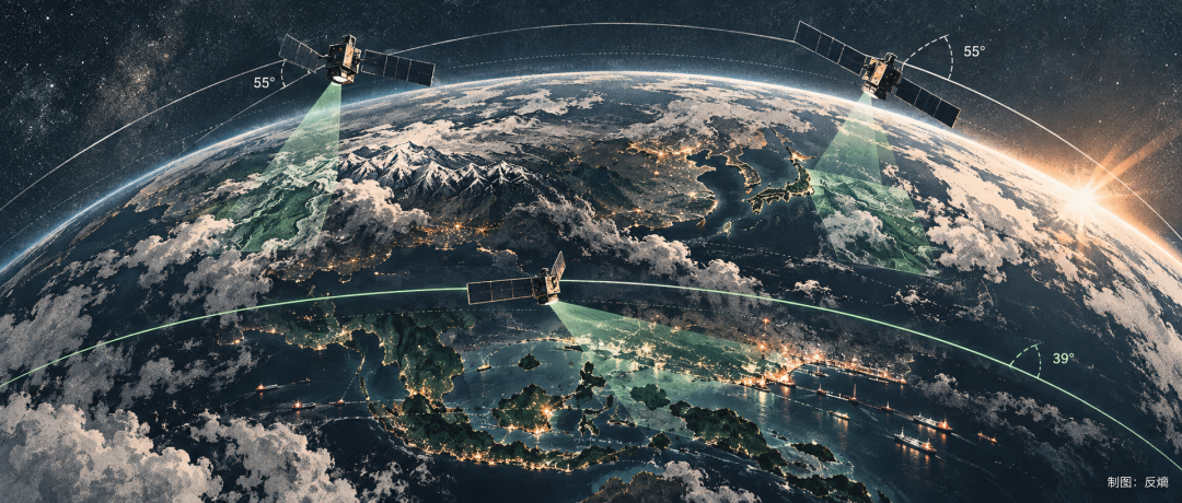
This is somewhat like the aviation industry. Both long-haul wide-body and regional aircraft can carry passengers, but their optimal designs differ entirely depending on the route network. The same goes for commercial remote sensing: the more specific the client and business scenario, the more the orbit becomes part of the product design.
Where a satellite flies and how often it returns are increasingly determined by market demand early on.
02
As satellites bring back more data, what's next?
Unlike optical remote sensing, which relies on sunlight reflection for imaging, SAR actively emits microwaves and receives echoes, enabling day-and-night operation and better adaptability to cloudy or rainy weather. However, transforming SAR data into human-readable and algorithm-usable information requires complex signal processing and imaging.
As resolution improves, swath width expands, and the number of satellites increases, data volumes grow rapidly.
Traditionally, satellites collect data, which is then imaged, filtered, and analyzed on the ground. Ground-based power and computing resources are far more abundant than on satellites, making this model still effective today. However, for time-sensitive tasks, the link (link) can seem too long.
A SAR satellite may capture a vast sea area, but clients may only care about a few ships. After flooding, people want to know which roads are submerged and which dike sections are at risk, rather than receiving massive raw data first and waiting for ground processing.
Thus, some computing is shifting to orbit.
The Xingliantian Yuan YG01 carries an onboard computing platform and intelligent processing software developed by Beijing Kanyun Zhichuang, enabling on-orbit SAR imaging, target detection, and recognition. The four SAR satellites launched by Galaxy Space on September 19 are also equipped with onboard intelligent processing and mission planning payloads. Its previously developed SAR satellites can already perform on-orbit data filtering, preprocessing, and information extraction.
Satellites are thus beginning to exhibit edge computing node characteristics. They no longer just send data back to the ground as completely as possible but first filter and process it, determining which information is more important or which anomalies need priority transmission.
This mirrors changes in the ground world. Cameras don't need to send every frame to the cloud before detecting intruders; cars don't send all sensor data to data centers before deciding to brake. Data is processed as close as possible to where it's generated because communication has bandwidth limits, transmission has latency, and ground processing has queues.
Of course, onboard computing is constrained by power consumption, heat dissipation, device reliability, and computing resources, so it won't replace ground data centers. However, task division is changing. Satellites used to focus on “seeing,” but now they're also starting to “understand” partially.
03
After satellites observe more frequently and process more data on orbit, the next bottleneck is how to quickly send information back to the ground.
In January, the Aerospace Information Research Institute of the Chinese Academy of Sciences conducted a super-100G satellite-ground laser communication operational application experiment using AIRSAT-02. Without replacing satellite hardware, laser communication rates were increased from 60Gbps to 120Gbps through on-orbit software reconfiguration. The experiment achieved second-level acquisition and link establishment, with a maximum continuous communication time of 108 seconds and 12.656Tb of data acquired at once.
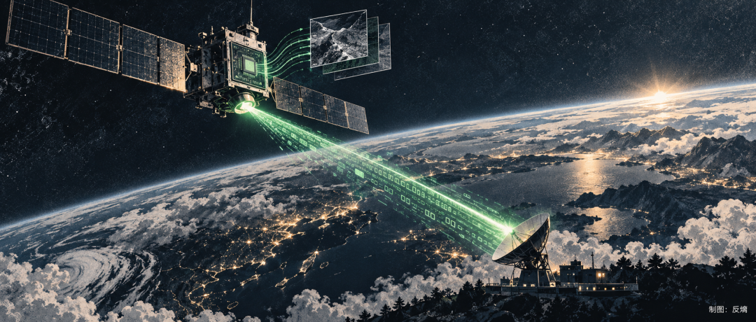
120Gbps is already fast, but laser communication also has clear limits. Laser beams are narrow, requiring high acquisition, pointing, and tracking precision. Clouds and atmospheric conditions also affect satellite-ground links, so for a considerable time, it will likely be used in conjunction with traditional microwave communication.
The real issue is matching capabilities within the entire system.
As front-end payloads become more powerful and satellites acquire more data daily, with onboard computing added in the middle, if the downlink can't keep up, previous capabilities will ultimately be bottlenecked at the communication stage.
Such bottlenecks are familiar in the information industry. No matter how strong a processor is, if storage and bandwidth can't keep up, overall efficiency suffers. Similarly, in data centers, deploying more GPUs won't fully release computing power if network bandwidth is insufficient. After satellites enter high-frequency observation and on-orbit computing, they face similar issues.
Thus, resolution, swath width, and payload performance remain important but are no longer sufficient to explain a commercial remote sensing satellite's overall efficiency. How much data is acquired, how much can be processed on orbit, and how quickly it can be sent back to the ground increasingly test whether the entire system is well-matched.
04
The most easily communicated metric for commercial remote sensing has long been resolution.
1 meter, 0.5 meters, 30 centimeters—these numbers are intuitive and indeed determine how much detail a satellite can see. This competition will continue, but in more specific commercial scenarios, information timeliness is becoming equally important.
Imagery taken ten minutes after a flood versus two days later may have vastly different business value, even if resolution is identical. When monitoring landslides, ground subsidence, or dam safety, clients prefer to know about changes as early as possible.
Information expires.
In military theory, the famous OODA loop—Observation, Orientation, Decision, Action—was introduced by U.S. Air Force Colonel John Boyd. A core idea is shortening the time required for the entire loop. This theory has since been widely applied in military command and business management because many competitions depend not just on how much information one has but also on how quickly it can be turned into action.
Similar logic is emerging in commercial remote sensing.
Orbit selection determines how quickly a satellite can revisit a target area, onboard computing shortens data processing time, and high-speed communication ensures rapid delivery of results to the ground. Technologies previously in separate domains now converge on one goal: minimizing the time between ground changes and users receiving useful information.
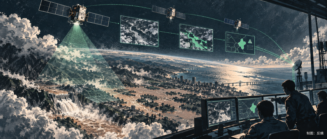
This means evaluation dimensions for commercial remote sensing are expanding. Resolution remains important, but revisit frequency, processing speed, and delivery timeliness will increasingly directly impact commercial value.
This is far more complex than simply adding more satellites because orbits, payloads, computing, communication, and ground systems must all align. A slowdown in any link will drag down the entire system.
Rockets will remain the most spectacular part of commercial space, but they ultimately just deliver cargo to orbit. Whether commercial space can generate sustained revenue depends more on what services these assets provide once in space.
As commercial remote sensing evolves from “taking a picture” to “quickly telling clients what's happening,” satellites are starting to seem increasingly smart.
-
![]()
ZTE’s New Doubao Phone: Playing It Safe in the AI Race
-
ZTE’s New Doubao Phone: A More Cautious Approach
-
![]()
Samsung, Spurred by Apple, Steps Up Its Game, with LY Technology Reaping the Greatest Benefits
-
Blue Heart Xiaov Set to Introduce Paid Pro Version, Revealing vivo’s Large Model Strategy
-
Three-Way Struggle for Market Share: BYD, Chery, and Geely Challenge Great Wall, Posing Immediate Risks to Wei Jianjun
-
![]()
The Reason Behind Valve's Headset Price Surge of 2400 Yuan: The End of an Era of Selling at a Loss
-
![]()
Decoding the '4S' Architecture | Report on Enterprise-Level AI Services in China
-
![]()
Li Auto Aims to Sell Three Technologies, First Buyers Unlikely to Be Major Automakers