China's Commercial Remote Sensing: A New Chapter in Sky Allocation
 10/22 2026
 397
When we observe Earth from space, the orbits we choose dictate how humanity directs its attention.
Beijing and Guangzhou are separated by nearly 2,000 kilometers, with a latitude difference of approximately 17°. For remote sensing satellites operating in near-polar orbits, these latitudes result in different orbital coverage conditions. Generally speaking, the higher the latitude, the easier it is for adjacent orbital strips to overlap on the ground. Conversely, near the equator, achieving similarly dense coverage typically requires either a wider imaging swath or a greater number of satellites.
On October 21, the Ceres-1 offshore launch vehicle's Yao-8 rocket lifted off from the coastal area of Rizhao, Shandong, successfully placing the Xiguang-IV 01 satellite into its predetermined orbit at an altitude of approximately 541 kilometers. As the first pathfinder satellite of the Wuyang Constellation, it was developed under the leadership of Guangzhou University, with Tianyuan Technology overseeing the project and Xi'an Aerospace Xiguang responsible for research, development, and manufacturing. Unlike common Sun-synchronous optical remote sensing missions, this satellite opted for a 39° low-inclination orbit, specifically designed to serve mid-to-low latitude regions.
01 The Overlooked Economics of Orbits
In 1972, the first Landsat satellite was launched, marking the beginning of a new era in Earth observation. Over the next half-century, near-polar orbits, particularly Sun-synchronous orbits, have become the backbone of numerous Earth observation missions. These orbits are ideal for covering vast areas and facilitating long-term comparisons of changes in the same region.
Sun-synchronous orbits take advantage of the precession of the orbital plane caused by Earth's non-spherical gravitational pull. This allows the satellite to pass over the same location at similar local solar times, minimizing interference from variations in illumination. When researchers compare two forest images taken years apart, for instance, they can be confident that any differences observed are due to actual changes in the forest, rather than variations in lighting conditions. This stability is a fundamental aspect of observation quality.
While global coverage offers many advantages, there is still room for optimization in orbit selection when it comes to high-frequency observations of specific regions. Satellites in near-polar orbits cross higher latitudes more frequently, where orbital strips are more likely to overlap. In contrast, users in tropical regions seeking short-interval repeat observations may need to consider alternative orbital arrangements.
In 1997, NASA and Japan jointly launched the Tropical Rainfall Measuring Mission (TRMM) satellite, which adopted a non-Sun-synchronous orbit with a 35° inclination to focus its observations on tropical and subtropical regions. By allowing its orbit to precess relative to the Sun, TRMM was able to acquire rainfall data at different local times, enabling the study of diurnal variations in rainfall. Low-inclination remote sensing is not a new concept; specific scientific missions have long influenced orbit selection based on their unique needs.
The Wuyang Constellation follows a similar approach, opting for an orbit design tailored to specific latitudes and applying this strategy to regionalized commercial remote sensing services. According to project plans, it will primarily serve southern China, as well as parts of Southeast Asia, Africa, and South America in mid-to-low latitudes, allocating more limited orbital access opportunities to these regions.
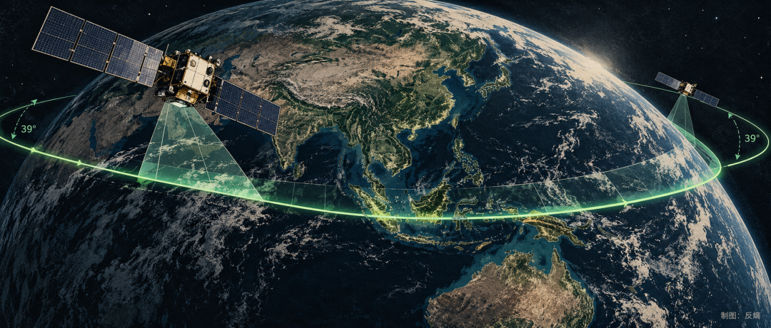
However, it's important to distinguish between orbital access frequency, actual imaging times (which can be more accurately described as 'the number of imaging operations'), and the final effective imagery obtained. Factors such as orbital altitude, payload field of view, side-swing capability, and constellation configuration all influence revisit periods, while cloud cover further affects the usability of optical imagery. The revisit efficiency advantages claimed by the project team can only be accurately assessed after defining specific comparison conditions.
Sun-synchronous orbits have long been the standard for global observations, while the Wuyang Constellation's choice of a 39° low-inclination orbit represents a strategic shift towards concentrating orbital access opportunities in specific latitude regions.
As satellites begin to design orbits around specific markets, orbital mechanics become more directly linked to commercial economics.
02 Remote Sensing Needs Different Eyes
While orbits determine when and from where a satellite observes, payloads determine what information it can acquire. Commercial remote sensing has traditionally emphasized easily communicable spatial resolution metrics, but the ability to see small objects in an image does not necessarily reveal what those objects are or how they have changed over time.
For example, abnormal colors in the same water body may indicate sediment or be related to algae growth. Hyperspectral sensors address this challenge by dividing electromagnetic waves into numerous narrow bands, using the unique absorption and reflection characteristics of different substances to provide a basis for identification. High-resolution optical cameras, on the other hand, excel at presenting ground object details with exceptional clarity. These two capabilities have their respective applicable scopes and design priorities.
Xi'an Aerospace Xiguang has long specialized in hyperspectral satellite development. The Xiguang-IV 01 satellite launched into orbit this time marks its first foray into high-resolution satellite research, development, and manufacturing. According to the project team, the satellite carries a 0.5-meter resolution high-resolution camera, a 2-meter multispectral camera, and a 30-meter wide-swath infrared payload. After this launch, the number of in-orbit satellites disclosed by Xi'an Aerospace Xiguang reaches 13.
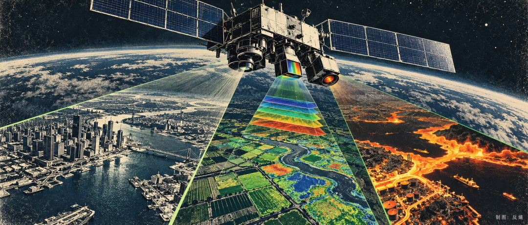
Expanding from hyperspectral to high-resolution capabilities presents significant challenges, particularly in migrating overall satellite capabilities. Hyperspectral imaging requires trade-offs among the number of bands, signal-to-noise ratio, and imaging swath, while sub-meter optical imaging is more sensitive to attitude pointing, optical precision, and thermal stability. When multiple payloads share a satellite platform, additional constraints arise in terms of power, heat dissipation, storage, mission sequencing, and data transmission links.
Xi'an Aerospace Xiguang undertook the overall satellite system design, full-satellite development, assembly, and testing, and participated in the integrated satellite-ground solution. For satellite manufacturing enterprises, expertise in single payload technologies can form professional advantages, while multi-payload integration and full-satellite development capabilities further broaden the range of missions they can undertake.
According to the Wuyang Constellation plan, hyperspectral, radar, and other satellites will be gradually deployed in the future, forming multi-source observation capabilities. Optical imagery is constrained by clouds and illumination conditions, while radar can supplement observations under complex weather and nighttime conditions. Aligning, fusing, and quality-controlling different data types will impose new system requirements.
Currently, the first pathfinder satellite of the Wuyang Constellation has successfully entered orbit, but the performance of relevant payloads, orbital maneuvering, and data processing capabilities still require in-orbit testing. The multi-source collaborative observation capabilities can be further verified after subsequent hyperspectral and radar satellites are deployed.
03 The Value of the Sky Is Determined on the Ground
Once a satellite enters orbit, each observation consumes limited imaging time, storage capacity, and data transmission bandwidth. Allocating resources to one region reduces opportunities to serve others. The economic significance behind this choice ultimately reflects how much effective data can be delivered per unit of investment.
US-based Planet has established a satellite observation network covering extensive areas and commercializes it through data subscription and analysis services. By the end of January 2026, the value of its recurring annual contracts accounted for 98% of its revenue. Continuously delivered data products have become an important path for commercial remote sensing enterprises to establish recurring revenue streams.
For commercial remote sensing, orbital access frequency determines observation opportunities, while the ability to deliver effective data per unit of system cost is closer to the actual efficiency of industry operations. Some tropical and subtropical regions experience frequent clouds and rain; optical satellites, even if passing frequently, may fail to obtain usable imagery due to cloud cover. Introducing radar can improve observation continuity under complex weather conditions but requires new satellite construction and operation investments.
Regionalized constellations can concentrate resources to increase observation density in target regions, but economic returns depend on whether sufficiently stable paid demand can be formed locally. Higher regional observation efficiency must be balanced with effective imaging rates, system costs, and customer procurement decisions.
Public remote sensing programs like Landsat and Sentinel have already made large amounts of basic data freely available; commercial remote sensing enterprises must differentiate themselves through higher spatial resolution, more timely observations, and industry-specific analysis services. For customers, imagery is just the starting point for data products; the reliability of continuous monitoring, accuracy of analysis results, and delivery speed are crucial factors in procurement decisions.

For over half a century, remote sensing satellites have continuously expanded humanity's ability to observe Earth. From global coverage to high-frequency observations of specific regions, technological progress has expanded the possibilities for orbit selection.
The Wuyang Constellation's choice of a 39° low-inclination orbit represents a practical attempt by China's commercial remote sensing sector to meet regional demands. Future in-orbit data and market applications will determine how far this approach can go.
Humanity cannot change Earth's latitudes, but it can redefine how we observe and understand our planet from the sky.
-
![]()
Post-85s AI Meteorology Entrepreneur from Changzhou, Jiangsu: Secures Multi-Million Funding
-
![]()
Why Is Light Able to Pass Through Holes Smaller Than Its Wavelength?—Exploring the Extraordinary Optical Transmission of Metasurface Infrared Filters
-
![]()
Film and Television Hurricane Delivers a Rigorous Review of the iPhone Duo! Withstands 10,000 Folds, Yet Falls Short in Software
-
![]()
Is the XPENG MONA L05’s Pre-sale Price 40,000 Yuan Steeper Than Its Rivals’?
-
![]()
Historic Windfall in Layoffs: BMW's Up to €650,000 Compensation Sparks Employee Exodus, Overwhelms System
-
![]()
Has Geely’s Debut Boxy SUV Shaken Up Off-Road Pricing?
-
![]()
GM China Reports $210 Million Net Profit in Q3: Two Consecutive Years of Profitability, Though CEO Warns of Tougher Market Conditions
-
![]()
BMW Layoffs: Employees Compete to Leave!